Toode kohal
Jah
*Kaup kätte kulleriga või pakiautomaadist varasemalt 03.04
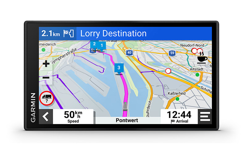
This 6″ sat nav features custom routing1 based on the size and weight of your truck, strategic suggestions for fueling and breaks, and leading-edge arrival planning.
Keep it clear and easy with a crisp high-resolution 6″ display.
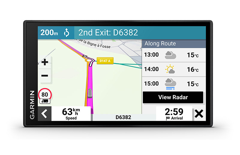
Get the best route for your truck with custom truck routing1 and road warnings, such as steep grades ahead.
Execute a smooth arrival with aerial views of loading docks and truck entrances.
Plan like the pro you are. See the best places for fuel stops, comfort breaks and overnight stays.
Get guidance and warnings about Environmental Zones on your route.
Time for a break? Truck Parking Europe data displays along your route.

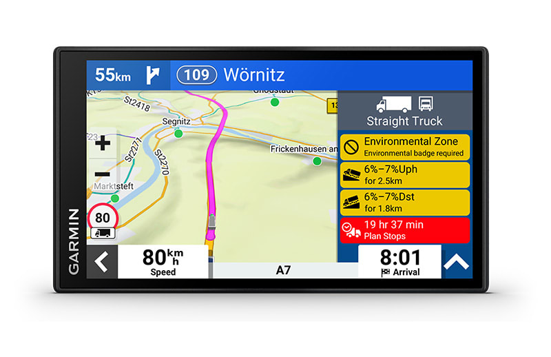 | 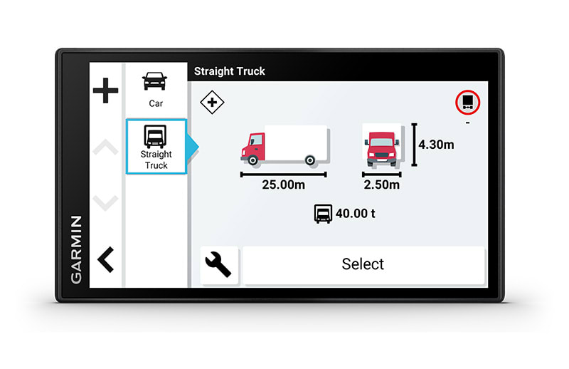 | 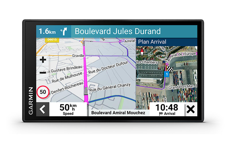 |
| EASY-TO-READ DISPLAY | CUSTOM TRUCK ROUTING | EXPERT ARRIVAL PLANNING |
| A bright 6″ touchscreen display provides a crisp high-resolution image. | Just enter your truck profile (customisable by height, weight, length, width and hazardous materials) to find truck-preferred routes1 best suited for your truck and load. | BirdsEye Satellite Imagery makes arrival planning run smoothly with aerial views of loading docks, truck entrances and security gates. |
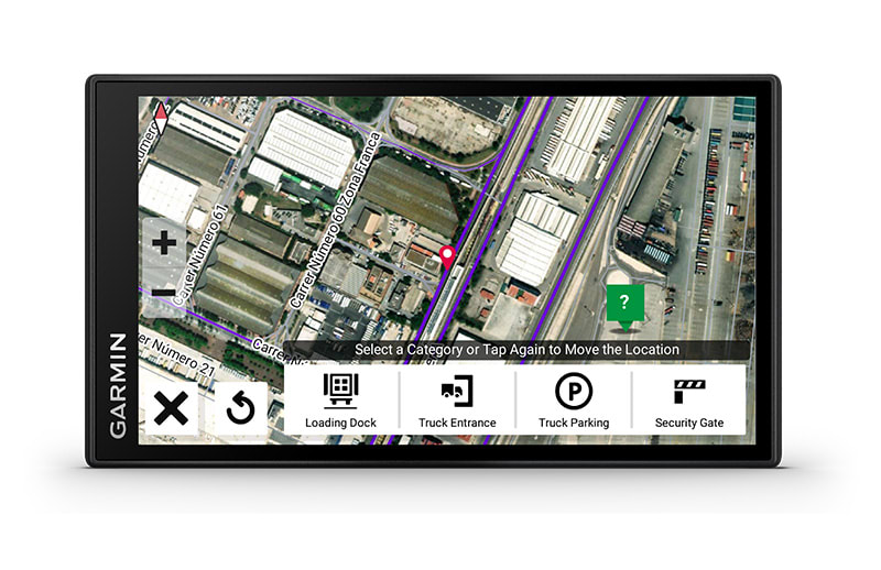 |  | 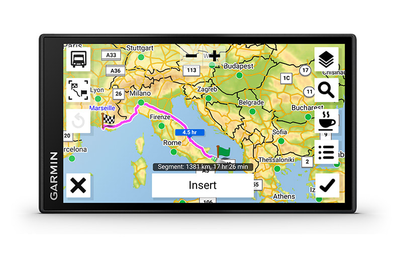 |
| CUSTOMISE YOUR ARRIVAL | INFORMED ROUTING | ROUTE OVERVIEW |
| View your destination, then add and save custom arrival points such as preferred security gates, loading docks and truck parking entrances. | See popular routes used by other truckers for better situational awareness — even in unfamiliar territory. | Easily view your complete route, and determine the best places for fuel stops, comfort breaks and overnight stays. |
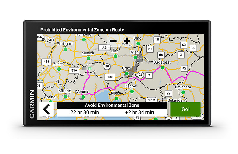 | 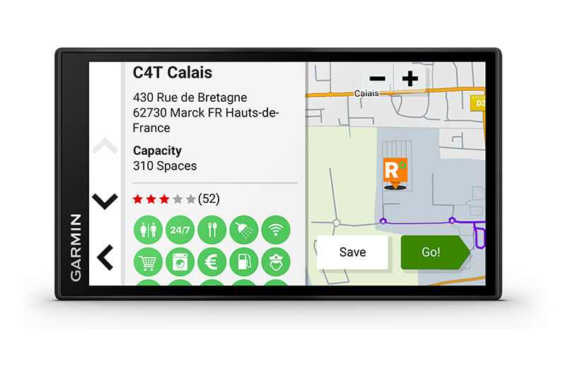 | 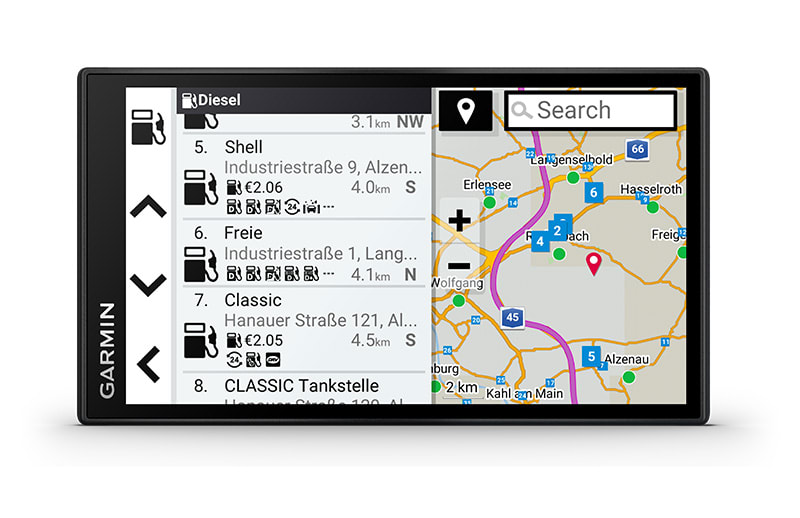 |
| ENVIRONMENTAL ZONE ROUTING | TRUCK-FRIENDLY PARKING | PICK THE RIGHT STOP |
| Get guidance and warning about Environmental Zones on your route. | Need to park your truck? Truck Parking Europe data helps you locate truck parking along your route. Filter by preferred amenities such as Wi-Fi®, showers, security level and much more. And while connected with the Garmin dēzl™ mobile app, check on parking availability to reduce the risk of driving to a crowded place. | Locate preferred truck stops with the preloaded directory of Truck & Trailer Services. It lets you filter listings by brand or amenity. |
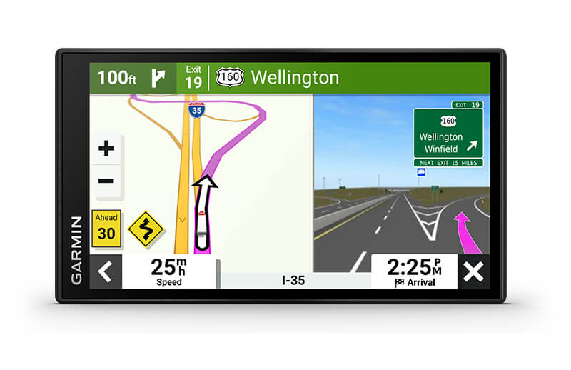 | 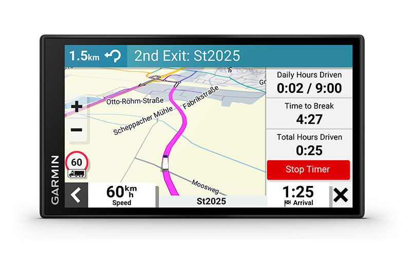 | |
| DRIVER ALERTS | EASY BREAK PLANNING | |
| To encourage safer driving and increase situational awareness, driver alerts warn you of upcoming sharp curves, speed changes, railway crossings and more. | Receive timely notifications that help make the most of each stop. |

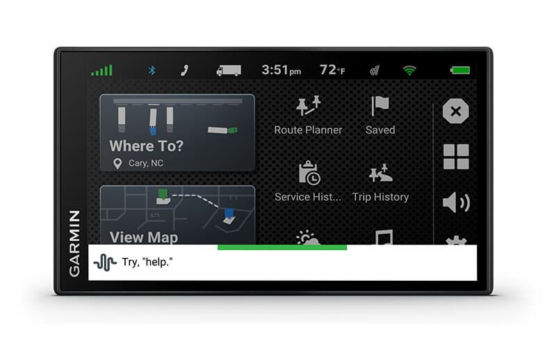 |  |  |
| GARMIN VOICE ASSIST | WIRELESS UPDATES | TRAFFIC, WEATHER AND FUEL PRICES |
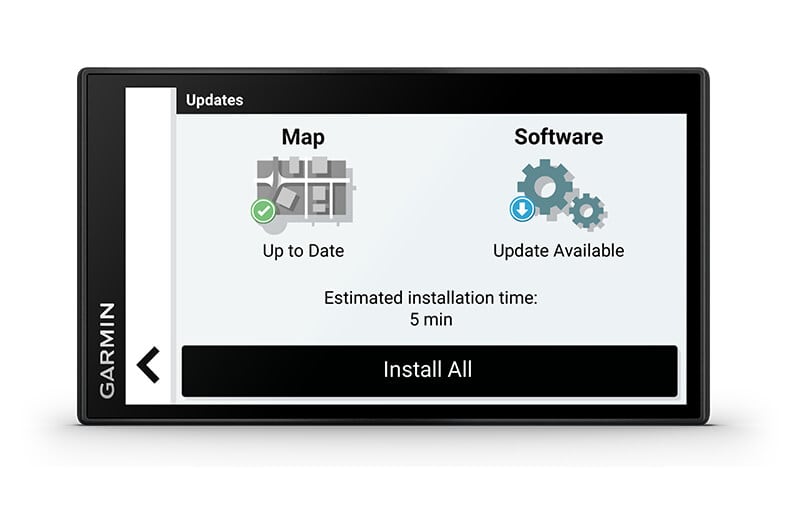
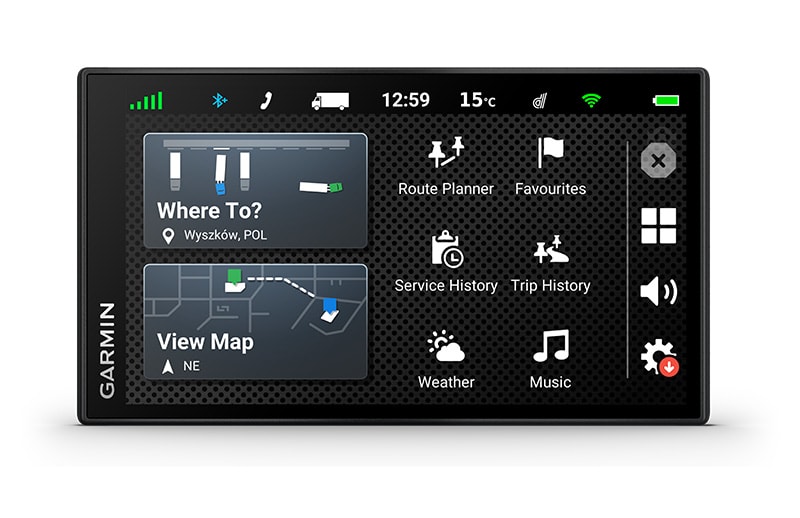
| Need directions? Just say the word. Garmin voice assist responds to your spoken request, so your hands can stay on the wheel, and your eyes can stay focused on the road. | Built-in Wi-Fi® connectivity makes it easy to keep your maps and software up to date without using a computer. On-screen cues show when new updates are available. | Download the dēzl app to access live traffic, weather and real-time fuel prices. Plus, access photoLive traffic cameras where available. |
 |  | |
| HANDS-FREE CALLING | SMART NOTIFICATIONS | |
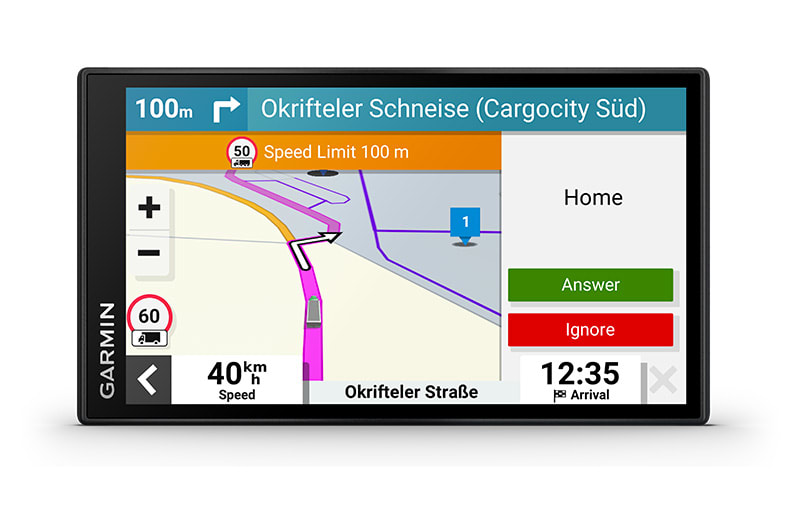
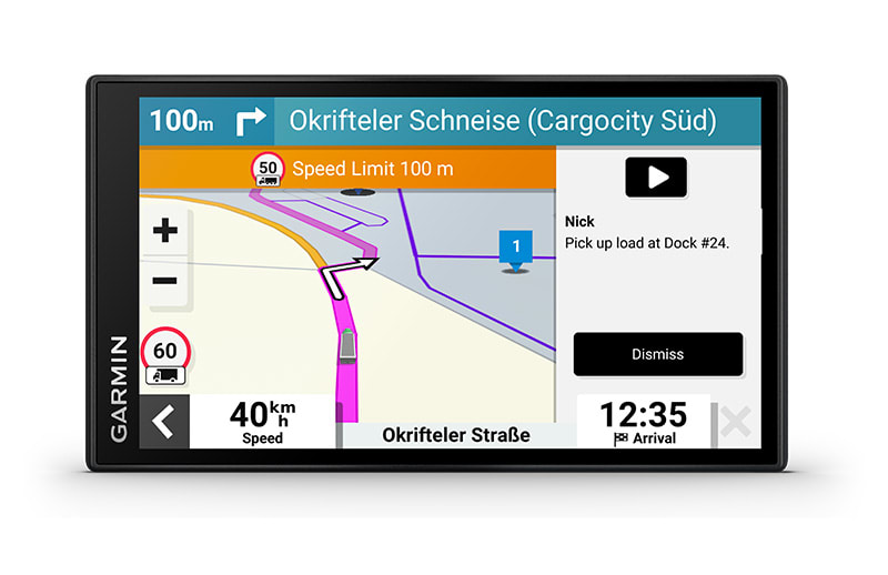
| Built-in BLUETOOTH® wireless technology lets you sync your compatible smartphone with your dēzl sat nav to make calls without taking your hands off the wheel. | When paired with the dēzl app, you’ll be able to see text messages and other notifications displayed on the sat nav’s screen. |

 |  |  |
| TRAVEL INFORMED | MAP COVERAGE | ADD A BACKUP CAMERA |
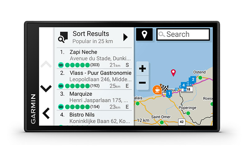
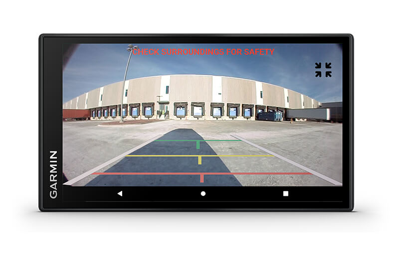
| View Tripadvisor® traveller ratings for hotels, restaurants and attractions along your route or near your destination. Preloaded Foursquare® content makes it easy to find millions of new and popular places. | Drive confidently with map updates and detailed street maps of Europe and Southern Africa. | See what’s behind your truck with a BC™ 50 wireless backup camera (sold separately). |
1 Not available in all areas. Entering your truck’s profile characteristics does not guarantee your truck’s characteristics will be accounted for in all route suggestions. Always defer to all posted road signs and road conditions.
© HERE. All rights reserved. Satellite imagery ©2022 Maxar Technologies (date of satellite imagery may vary). Wi-Fi and the Wi-Fi logo are registered trademarks of the Wi-Fi Alliance. The Bluetooth word mark and logos are owned by the Bluetooth SIG, Inc. and any use of such marks by Garmin is under license. ©2022 TripAdvisor LLC. All rights reserved. foursquare® and the foursquare® logos are registered trademarks of Foursquare Labs, Inc. All rights reserved.
Üldine | |
| FÜÜSILISED MÕÕTMED | 15.2 x 8.6 x 1.9 cm |
|---|---|
| EKRAANI SUURUS | 14.5 x 8.1 cm; 6″ (15.24 cm) diagonaal |
| EKRAANI ERALDUSVÕIME | 1280 x 720 pikslit |
| EKRAANI TÜÜP | 6″ IPS, puuteekraan, klaas, HD värviline TFT |
| KAAL | 176 g |
| AKU TÜÜP | laetav liitium-ioon |
| AKU KASUTUSAEG | kuni 1 tund |
Kaardid ja mälu | |
| EELLAADITUD TÄNAVAKAARDID |  |
|---|---|
| MÄLUKAARTIDE LISAMISE VÕIMALUS | microSD™ card (ei kuulu komplekti) |
| 3D MAASTIK |  |
| SISEMÄLU | 32 GB |
| VÕIMALUS LISADA KAARTE |  |
| SISALDAB KAARDIUUENDUSI |  |
| ALLALAADITAVAD SATELLIITKUJUTISED |  |
Andurid | |
| GPS |  |
|---|---|
| GALILEO |  |
Kaamerafunktsioonid | |
| TAGAKAAMERAGA ÜHILDUV |  |
|---|---|
Navigatsioonifunktsioonid | |
| RAKENDUSE GARMIN REAL DIRECTIONS™ MAAMÄRGIJUHISED |  |
|---|---|
| MILJONID TEENUSE FOURSQUARE® HUVIPUNKTID |  |
| TEENUSE TRIPADVISOR® REISIHINNANGUD |  |
| MARSRUUDI KAVANDAMINE LÄBI EELISTATUD LINNADE/TÄNAVATE |  |
| HÄÄLJUHITAV NAVIGATSIOON (SEADME JUHTIMINE HÄÄLJUHISTEGA) AINULT KOGU EUROOPA VERSIOON |  |
| LIIKLUSUUENDUSED |  |
| SÕIDURAJAABI KOOS RISTMIKUVAATEGA (KUVAB RISTMIKU LIIKLUSMÄRGID) |  |
| BLUETOOTH® KÕNED |  |
| KIIRUSEPIIRANGU NÄIT (KUVAB EUROOPA PEAMISTE TEEDE KIIRUSEPIIRANGU) |  |
| JUHI HOIATAMINE JÄRSU KURVI, KOOLIALA, PUNASE TULE JA KIIRUSKAAMERA JNE KORRAL |  |
Üksikasjalikud funktsioonid | |
| NUTITEAVITUSED RAKENDUSE KAUDU |  |
|---|---|
| WI-FI® KAARDI- JA TARKVARAUUENDUSED |  |
| RAKENDUSE ABIL JUURDEPÄÄS REAALAJATEENUSTELE |  |
Ühenduvus | |
| NUTITELEFONIPLATVORMIGA ÜHILDUV | iPhone®, Android™ |
|---|---|
| TÖÖTAB GARMINI RAKENDUSEGA ÜHILDUVAS NUTITELEFONIS | Jah (rakenduse Garmin dēzl™ kaudu) |
| VAJAB BLUETOOTH®-TOEGA NUTITELEFONI | Jah |
Veokifunktsioonid | |
| KAALUMISJAAMADE TEAVITUSED JA MÖÖDASÕIDU OTSUSED |  |
|---|---|
| VEOKIJUHTIDE HUVIPUNKTID |  |
| VEOKITE KIIRUSPIIRANGUD |  |
| VEOKI- JA HAAGISETEENUSTE KATALOOG |  |
| PÄIKESETÕUSU/-LOOJANGU KELLAAJAD – VEOKID |  |
| OSARIIGI- JA RIIGIPIIRIDE TEAVITUSED – VEOKID |  |
| SPETSIAALSED VEOKIMARSRUUDID |  |
| LIHTNE VEOKIPROFIIL |  |
| POPULAARSETE VEOKIMARSRUUTIDE ANDMED |  |
| KILOMEETRIPOSTI TEAVE – VEOKID |  |
| LAADIMIS- JA DOKKIMISJUHISED |  |
| IFTA KÜTUSELOGIMISE TUGI |  |
| TÖÖAJAMÄÄRUSTE RIKKUMISE HOIATUSED |  |
MT-D - mudelil karbis liikusinfo kaabel
MT-S - liiklusinfo läbi nutitelefoni rakenduse
